Publications
 Partners


These multi-billion dollar satellites are in orbit at an altitude of 19 200 km above the earth and travel at a speed in excess of 11 200 km/h while simultaneously transmitting low power radio signals to any active GPS receiver.
Since the early 1980s this technology has become freely available for commercial and private use and today it is unthinkable for any plane, ship, or overlanding explorer to be without it. Most luxury sedans are having GPS systems fitted as standard equipment and even PDAs (Personal Digital Assistants) such as Compaq's Ipaq, can be fitted with a mobile GPS receiver.
Of the 24 satellites in orbit, three are actually back-up systems, with 21 being operationally active.
The transmitted radio signal is too weak to penetrate buildings, caves and underwater, and requires a line of sight to a minimum of four satellites in order to provide an accurate fix for position, speed and altitude. Owing to their high earth orbit, this is virtually guaranteed from any place on the earth!
GPS or NAVSTAR (Navigation Satellite Timing and Ranging, a US Department of Defence naming convention !) actually consists out of three different segments, being:
- The User Segment
- The Control Segment
- The Space Segment
The User segment is simply you and the GPS receiver.
The Control Segment consists out of five base stations on earth, of which four are unmanned and one is a master control station. By downloading information from the satellites, sending it to the Master Control station and then up-linking the corrected information back to the satellites, they provide corrected orbital and timing information to ensure absolute accuracy at all times.
The Space Segment consists out of the aforementioned 24 solar powered satellites in orbit. They have a life span of approx. 10 years and are constantly updated and replaced at a cost of billions of dollars by the US Department of Defence.
A satellite can transmit at different low power radio frequencies, designated L1, L2 etc.
Normal private and commercial GPS receivers listen to L1, which operates at UHF 575.42 MHz.
To put this amazing technology in perspective, a normal FM radio station has a power output of approx. 100 000 watts. A GPS Satellite transmits at only 20-50 watts at a range of 19 200 km.
Considering that a mobile receiver operates on a couple of AA batteries, it becomes truly overwhelming.
The L1 frequency referred to previously, actually contain two "pseudo-random" digitally encoded signals, called the P-code (Protected) and C/A-code (Coarse/Acquisition). The P-code is scrambled , referred to as "anti-spoofing," to ensure that unauthorized access is prevented and is referred to in the industry as the P(Y) or "Y" code.
The main objective of the coded signals is to calculate the time it takes to travel from the satellite to a GPS receiver on the ground. This is referred to as the Time of Arrival and thus the distance is calculated by multiplying the time it takes by the known speed of light. (Distance = Speed x Time).
The slight time delay is caused by the signal travelling through the atmosphere at a speed of approx. 300 000 km/ second. In addition to this the Navigation Message the satellites sends a GPS receiver, will contain orbital, clock, and general system messages. Accuracy is ensured by using atomic clocks for the satellite signals.
As mentioned before, by applying the distance formula, the GPS can work out the Time of Arrival. Once this is known, a GPS receiver also needs to determine the exact location of the satellites. This is done by receiving two additional coded signals, called the "almanac" data and the "ephemeris" data. Let us examine both of these briefly:
The almanac data is periodically updated and contains the approx. position of the satellites in orbit. This is constantly transmitted and stored in the GPS receiver memory as the satellites move around in their orbit.
However, as with most satellites, they can slightly move out of their exact orbits and this change is tracked by the ground control stations as mentioned previously. Correcting these "orbital mistakes" are vital and is beamed back up to the satellites by the Master station on the ground.
This corrected information is known as the ephemeris data. Now, combining the almanac data with the ephemeris data allows a GPS receiver to accurately know the exact position of each satellite.
Having the above information, thus makes it possible to actually determine our own position on earth. For instance, we could be 15 000 km away from Satellite #1.
Our position is therefore somewhere on the edge of an imaginary circle, (with a radius of 15000 km) with Satellite #1 in the centre.
At the same time, we could be 18 000 km away from Satellite #2.
This would place us somewhere on the edge of another imaginary circle, this time with a radius of 18 000 km with Satellite #2 at the centre.
The two circles overlap and thus create a common sphere.
Should we add a third satellite (#3) at a distance of say, 1 7000 km, we will now have two common points where the three circles overlap.
Draw this on a piece of paper to visualise it better.
Although there are two possible locations for us, they will greatly differ in terms of latitude/longitude and altitude.
By manually adding your altitude, the GPS will be able to determine a two dimensional fix of your position.
Should your GPS receiver be in line of sight of a fourth satellite, maybe at 20 000 km, we can add another fourth intersecting circle, but this time with a single common point! Thus, we have an exact latitude, longitude, and altitude now.
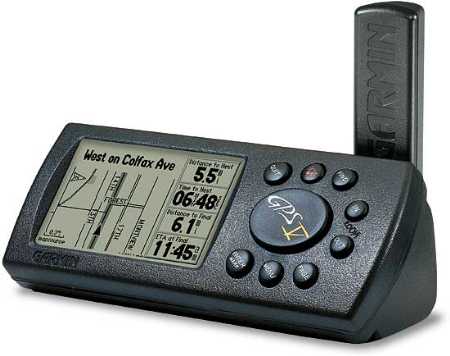
A number of GPS receivers will indicate your position on an on-screen map, which makes for easy navigation.
These maps can nowadays be downloaded from CD or the Internet.
It is important to remember that a GPS receiver will lose its "almanac" data (otherwise known as the exact location of the satellites in orbit) if it has been turned off for a period of about 5 hours.
We refer to this as a GPS having gone cold. The GPS unit will thus take longer (about 30 seconds) to re-acquire the exact positions of the satellite, before a new location fix can be generated. A unit that is "warm" will do so immediately.
In summary, a number of potential errors need to be taken into account when dealing with commercial or private GPS receiver technology. These are mainly:
- Selective Availability:
Before venturing out there with your new mobile GPS system, remember to purchase spare batteries, as most receivers will only function for 24 hours continually with a normal set of AA batteries!