Publications
 Partners


Johannesburg - Back in the heyday of road travel in the early 60s, if you wanted to drive from Johannesburg to Durban you would have had to take a winding route that ran from town to town. This was a simple two-lane blacktop road that joined many of the small towns and provided a scenic and often historic route between the two destinations.
As road and cargo traffic increased, the then National Road Agency was put to task by government to upgrade the artery to compensate for the growing number of vehicles travelling between Johannesburg and Durban, and to put in place a development plan that would see the route become world-class.
The beginning
Work began on the route in 1961, with the first of 12 sections starting between Durban and Pietermaritzburg, and would continue for four decades as the road was widened and the small towns bypassed. The final section of the route now known as the N3, was completed in 2001 between Villiers and Heidelberg, and would now see the N3 route as one of South Africa’s longest continuous four-lane freeways.
The N3 freeway begins in the Durban CBD, traverses KwaZulu Natal, the Free State, Mpumulanga and Gauteng for over 590km, with the four-lane blacktop finally ending at the Beccleuch Interchange on the Johannesburg ring road.
It passes a multitude of natural and historic points along its winding path, many of which are just a few kilometers off the freeway. It has come a very long way from the route that travellers took so many years ago.

Image: Supplied by AutoTrader SA
Economic development for SA
The main reason for the existence of the N3 toll route is economic development.
The N3 is the main artery between the Port of Durban and the business centre of South Africa in Johannesburg, and is also the lifeline to the rest of the country from there.
Over 58 million tons of cargo travel this route every year, and the volume is increasing. The route is used mainly by cargo trucks and travellers and anywhere between 8500 and 13500 vehicles per day will make use of the route. This can spike to over 2000 vehicles per hour on a particular stretch during peak holiday times.
Due to the ever-increasing number of freight operators and travellers making use of the road, and a major bottleneck at the Van Reenen’s Pass, a new bypass has been in the planning stages for over 15 years.
The De Beers bypass would see a new stretch of freeway built that would separate just before the town of Warden, bypassing Harrismith and emerging just before the Tugela Toll plaza, taking a much easier route over the escarpment and cutting the journey along the existing N3 route by 20 minutes. This planned bypass will save hundreds of thousands of Rands, and divert the heavy truck traffic on Van Reenen’s Pass to almost zero.
Income loss
This might sound advantageous to all concerned, but the downside is, as soon as a town is bypassed by a speedier route, the local townsfolk who depend on the travellers to stop and spend money lose their income. Nowhere is this more apparent than the towns of Warden, Colenso, Winterton and Estcourt, and many townsfolk of Harrismith would share the same fate if and when the De Beers bypass should happen.
The N3 is managed by a concession that has been charged with maintenance and safety as well as the tolling of the route. A one-way trip between the two cities will see you having to pay over R229 in toll fees if you driving a normal sedan. These funds are directed by the N3 toll concession into patrolling, maintaining and upgrading the route.
Evidence of this is plain to see as the N3 has an incredibly fast response team that deals with all manner of accident and breakdown; fixing and clearing the road to keep everyone moving.
With Durban handling over 40% of the country’s imports and exports, the N3 corridor between Durban and Johannesburg is a vital lifeline contributing to 33% of South Africa’s GDP but it isn’t the only reason to appreciate this road.
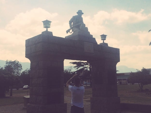
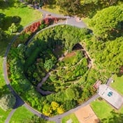
Along the route are many beautiful and historic places to explore, such as the Howick Falls, historic battlefields, national parks and panoramic vistas that can only be found on a road that has so much history and importance. South Africans like to drive, and every now and again it does good to explore the roads we drive.
So the next time you’re on your holiday drive, maybe choose to take this amazing stretch of road, and go exploring - follow those brown-and-white signs to a piece of South Africa’s cultural, historical and natural heritage.
Sources
N3 route: (Wikipedia) https://en.wikipedia.org/wiki/N3_road_(South_Africa)
Arrive Alive: https://www.arrivealive.co.za/Managing-Safety-on-the-N3-Toll-Route
N3TC: http://www.n3tc.co.za/
Engineering News: http://www.engineeringnews.co.za/article/proposed-r53bn-expressway-to-increase-safety-productivity-of-n3-road-users-2015-02-26